
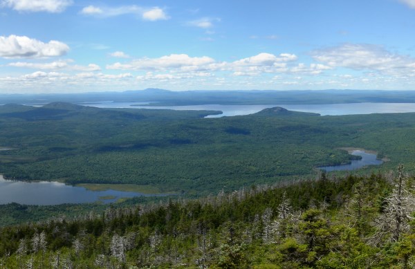
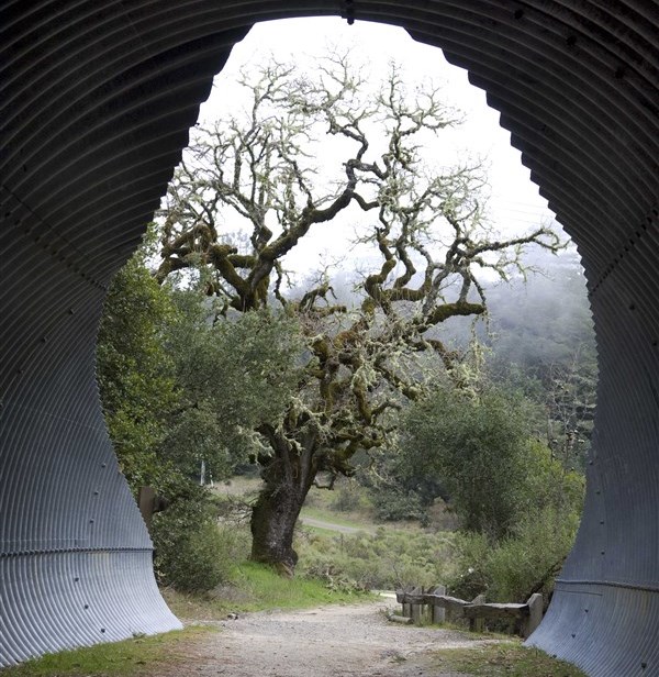
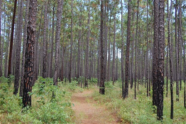
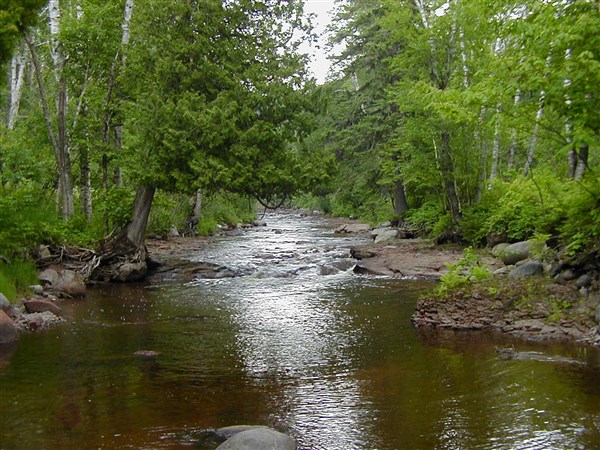
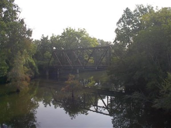
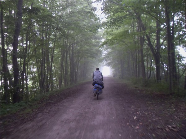
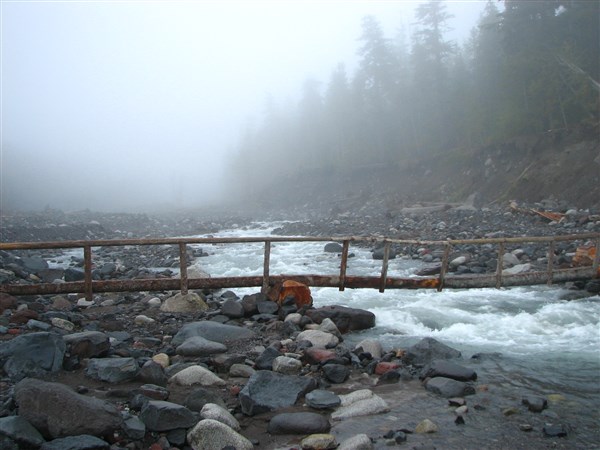
1. North Country Trail
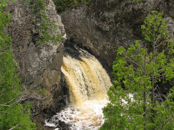
Length: 4600 miles
Region: Northern United States
Endpoint 1: Crown Point, New York
Endpoint 2: Lake Sakakawea State Park, North Dakota
Shoulder a pack, lace up your boots and heat out to explore this scenic and amazing trail. You can throughout the year, until snow blocks your path. It cuts through seven states, from prairies on the Great Plains to the glacier-filled landscapes in Adirondack Park. If you want to explore large sections of the U.S.A through the jungle, the North Country Trail is just what you need to follow. Cutting through more than 100 state forests and national parks, as well as 10 national forests, the trail gives millions of hikers each year, a view into some of the finest natural locations that North Dakota, Minnesota, Wisconsin, Michigan, Ohio, Pennsylvania and New York have to offer. You will experience sublime scenery in places such as Pictured Rocks, with cliffs and lighthouses over Lake Superior. During fall, experience the sight of changing leaves and the smell of grape harvest, in Finger Lakes, New York. Established more almost 40 years ago, the North County Trail is yet to be completed. Hikers follow abandoned railroad beds, miles of dirt roads, national forests and newly cut trails, giving you the best combination of what nature has to offer.
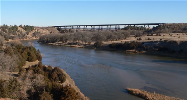
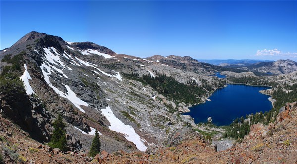
2. Continental Divide Trail

Length: 3100 miles
Region: Rocky Mountains
Endpoint 1: Mexico
Endpoint 2: Canada
The Continental Divide Trail, otherwise known as the CDT is one of the best and toughest hiking trails that North America has to offer. Although it is challenging, certain sections of the trail are unbelievably breathtaking. Most hikers are attracted to the CDT after testing their hiking skills in the Appalachian Trail and the Pacific Trail. If you hike all 3 in your lifetime, you become a hiking royalty. No doubt about that. Few people manage that feat. Although the Continental Divide Trail is not as popular as the Appalachian Trail and the Pacific Trail, it offers lots of adventure, for the 4 to 5 months that you will be in the jungle. Take the word trail with a pinch of salt because there are large sections of road walking, coupled with route finding in unmarked terrain. You can call them cross-country if you prefer. This is where your navigation skills are brought to the fore. It is not surprising that most hikers tackle the CDT after they have developed extensive hiking and navigation skills. The trail cuts through numerous terrains and ecosystems, including the Chihuahuan Desert in New Mexico, Mountains rising to over 14,000 feet in Colorado and grizzly bear territory as you step in Montana.
3. East Coast Greenway
Length: 3000 miles
Region: Eastern U.S
Endpoint 1: Calais, Maine
Endpoint 2: Key West, Florida
You can take a road trip or a mountain hike across America. However, no adventure is as epic and breathtaking, as hiking across the East Coast Greenway in one path. Although it is not very popular among new hikers, it is an awesome project, which is also used as a biking path. It passes through a wide range of amazing diversity, with lots of cultural and natural history along the route. It also connects diverse landscapes, from the storied rocky coast in Maine, to the palm-lined sandy beaches in Southern Florida. From the gateway to the Canadian Maritimes to historic mill cities and coastal communities, you will experience some of the best adventure in your lifetime that Maine has to offer. The northerly portion at the Canadian border offers two portions. You can either take the 85-mile Down East Sunrise Trail, passing through the blueberry barrens or take an alternate road route, if you don’t trust your navigation skills. What makes it particularly interesting, is the timeless and beautiful scenery that you will encounter along the way. It also remains one of the safest hiking trails in the U.S.
4. Pacific Crest Trail

Length: 2654 miles
Region: West Coast
Endpoint 1: Mexico
Endpoint 2: Canada
Have you ever wondered what it feels like to hike through some of the most outstanding scenic beauty in the United States? Well, you don’t have to imagine anymore. The Pacific Crest Trail is all yours. Thousands of equestrians and hikers enjoy this national treasure each year, and there is no reason why you shouldn’t be one of them. Spanning more than 4,000 kilometers from Mexico to Canada, it brings to you the beauty of the desert, reveals the glaciated expanses of the Sierra Nevada, and provides some of the most commanding vistas, which you will encounter on the Cascade Range of volcanic mountains. As you can see, this trail is a symbol of everything there is to love in the Western United States. Whether you are only hiking a few miles, or you intend to complete the entire trail in a single season, the choice is all yours. One of the best sections along the trail is the Snoqualmie Pass. For more than 75 miles, you don’t encounter any road. As you complete this section, you will hike through some of the most diverse and remote mountain country along the trail. It passes through a dozen of lakes, most of which are swimmable during late summer. However, the lakes are not the only attraction; you will encounter views of towering mountains, and meadows. Pure beauty, fun and adventure awaits you in the Pacific Crest Trail.
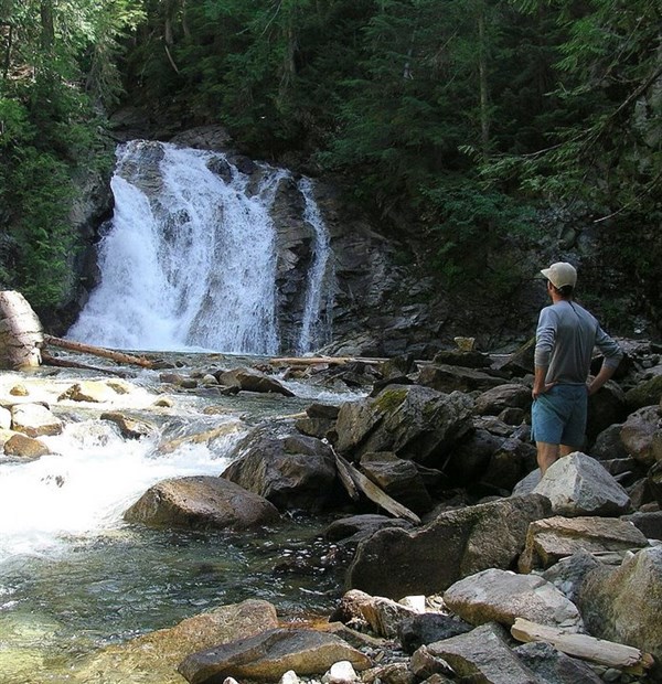
5. Appalachian Trail
Length: 2189 miles
Region: Appalachian Mountains
Endpoint 1: Georgia
Endpoint 2: Maine
Without a doubt, the Appalachian Trail is the most famous and longest hiking-only footpath in the U.S. Running from Maine to Georgia; this public footpath traverses the wooded, scenic, pastoral, wild and culturally rich lands of the Appalachian Mountains. Started in 1921, it was completed in 1937 by private citizens. With over 2 million visitors per year, the Appalachian Trail attracts hikers from all parts of the world. If you are Northbound, most people start at Springer Mountain. Being the most popular place to begin the thru-hike also means that the place is usually crowded from 1st March to around 15th April. Therefore, if you are northbound, delay your trip a little bit to avoid the stream of hikers and the overcrowding along the campsites. You can also choose to start at the middle of the trail. This gives you a gradual progression along the terrains as well as more resupply points. It also means that you will avoid the overcrowding and party atmosphere, enjoy favorable weather and reduce resource damage to the trail. If you consider yourself a hiking ninja, then you can start your thru-hike at Maine. Truth is, this is not the place for the weak. Most people who have hiked the entire trail will tell you that Katahdin is the most difficult mountain to climb on The Appalachian Trail. Whichever way you choose, just enjoy the trip.
6. Ice Age Trail

Length: 1200 miles
Region: Wisconsin
Endpoint 1: Potawatomi State Park
Endpoint 2: Interstate Park
If you are looking for hiking, walking or backpacking, all these activities are available on the Ice Age Trail. Spanning more than 1000 miles in Wisconsin, the trail focuses more on the natural land formations that occurred during the Ice Age. With a rich history of more than 12,000 years, this trail is a landscape of remarkable beauty, featuring glacier remnants and a wide range of unique landscape features. As you travel through some of the most beautiful natural areas in Wisconsin, there are various opportunities for wildlife viewing, bird watching and sightseeing. During winter, certain sections of the trail are open for snowshoeing and cross-country skiing. A trip across the Ice Age Trail takes you through some of the most scenic Terrain in Wisconsin, including expansive prairies, mature forests and thousands of rivers and lakes, some that are swimmable during summer. The Wisconsin Glaciation on this trail is a series of ridges spread over 120 miles long. Other Geologic features include outwash plains, ice-walled lake plains, drumlins, eskers, kames, and tunnel channels, just to name a few. If you want to witness some of the most of the landforms created during the continental glaciations, then Wisconsin is the place to be.
7. Pacific Northwest Trail
Length: 1200 miles
Region: Pacific North West
Endpoint 1: Glacier National Park
Endpoint 2: Cape Alava, Olympic National Park, Washington
Regarded as one of the most scenic trails in the world, the Pacific Northwest Trail cuts across different landscapes, which include, the Rocky Mountains, the Pasayten Wilderness, Selkirk Mountains, North Cascades, the Wilderness Coast, and the Olympic Mountains. Although it is commonly confused with the Pacific Crest Trail, the Pacific Northwest Trail, commonly known as PNT among the hikers, runs perpendicular to the PCT for over 1200 miles, crossing the PCT at the North Cascades. As much as the trail is mapped out, you can say that it is relatively new, since some sections are not yet complete. It brings together old forest service roads, paved highways, dense vegetation, cow paths, and rocky ledges devoid of any paths. That unique combination of landscapes makes you really feel as if you are walking through America. The relatively short length but challenging terrain, combined with the solitude, makes it one of the best. The variety of landscape along the way will leave you in awe. From Glacier National Park to the Pacific Ocean, you will experience sagebrush deserts, dense and lush rainforests, seascapes and tidepools, cow poop and dust, rugged mountains and slow rolling hills, free loving hippies and even angry landowners. It brings together everything that you ever wished for.
8. Florida Trail
Length: 1000 miles
Region: Florida
Endpoint 1: Gulf Islands National Seashore
Endpoint 2: Big Cypress National Preserve
Florida presents a different hiking experience from what you are used to in other parts of the United States. The hiking season is somewhat backwards. While most northern hikers hit the trails during summer, hikers in Florida venture out during fall. Hiking during fall comes with various advantages like cool and pleasant temperatures as well as fewer mosquitoes. The uncomfortable moments along the way, combined with the shining moments, the forged friendships in the jungle, the majesty of the hills, the curious fauna and the sweet smell of flora, all make it a worthwhile experience. There are 8 distinct sections along the trail, which stand out. These are Alexander Springs to Farles Lake, Clearwater Lake to Alexander Springs, Pat’s Island to Hidden Pond, Hopkins Prairie to Salt Springs, Chuluota Wilderness to Joshua Creek, Mills Creek, Little Big Econ State Forest, and Seminole State Forest. Majority of long distance hikers prefer the western side of Lake Okeechobee. In this section of the trail, you will enjoy more scenic beauty. Sugar cane fields give way to vast palmetto-dotted prairies, with vast herds of cattle. Sunrises are amazing with sweeping panoramas in different directions. You will also experience wildlife sightings, interesting birds and several alligators. Give your eyes a feast!
9. Mountains-To-Sea Trail

Length: 1000 miles
Region: North Carolina
Endpoint 1: Clingman’s Dome, Great Smoky Mountains
Endpoint 2: Jockey’s Ridge, Outer Banks
The MST as it is popularly known is more than just a walk in the woods. If you are a nature lover, you will experience the great diversity of North Carolina. From ancient mountains to small Piedmont farms, colonial towns to coastal swamps, barrier islands and changing textile villages, adventure doesn’t get better than this. With over 700 miles currently completed, you can now follow the trail across North Carolina, climbing the highest sand dune and the tallest mountain peak in the United States. The highest elevation is approximately 6,684 feet, which is on Mt. Mitchell while the lowest elevation is at the sea level on Cape Hatteras National Seashore. Along the trail, you will pass through two national wildlife refuges and four national parks, meander through 3 national forests, pass 3 lighthouses, including the nation’s tallest, and enjoy two ferry rides. On the MST, the only constant is change. Its location in the center of Orange County makes it easily accessible by outdoor enthusiasts of all ages. Everything North Carolina has to offer, from the woods to the town is amazing and the whole trip is phenomenal.
10. Idaho Centennial Trail
Length: 883 miles
Region: Idaho
Endpoint 1: near Murphy Hot Springs
Endpoint 2: Upper Priest Falls
The Idaho Centennial Trail is a very wild, incredibly scenic and extremely remote hiking trail, running for approximately 1000 miles. Whether you are planning a weekend hike or short afternoon day hike, there are numerous short hikes along the trail. You can even hike the entire trail by breaking it down into sections and hike it at your own pace. On the other hand, if you are a seasoned backpacker, just hike the entire trail and experience extended adventure into the backcountry. With close to 1000 miles of rugged and rough backcountry travel, the Idaho Centennial Trail is guaranteed to keep you on your toes. As you cross the state from Nevada to Canada, the trail traverses some of the most isolated lands. From the lush western forests, to the desert of the Snake River plain, there is everything to love about Idaho. The ICT cuts through large tracts of Idaho’s protected wilderness. With only a few completed thru-hikes since its inception in 1990, the Idaho Centennial Trail presents a challenging and unique opportunity to all prospective hikers. Come and experience the incomparable remoteness and unmatched solitude of the ICT.
11. Oregon Desert Trail

Length: 750 miles
Region: Oregon
Endpoint 1: Oregon Badlands Wilderness
Endpoint 2: Lake Owyhee State Park
Are you dreaming of solitude and stars? Hike the Oregon Desert Trail and experience that and much more. Founded by the Oregon Natural Desert Association, the ODT connects old roads, remote mountains, canyons and dry lakebeds, cross-country travel and a mixture of trail. Explore places like the Steens Mountains, and the Owyhee Canyonlands, which immerse hikers into some of the most remote lands the country has to offer. The perfect time to explore the ODT is during the cool autumn days. Solitude is abundant. If you have encountered heavy traffic along other trails, the ODT will give you a breath of fresh air. With the growing popularity of long-distance hiking, it is quite hard to find real solitude on the major trails. However, the ODT is not your average hiking trail. It is both exciting and challenging. Soak the pains and aches of the day in one of the numerous hot springs found along the trail. Did you know that the oldest human remains in North America were found in this part of the country? The high desert is home to various desert species, including the sage grouse, pronghorn, jackrabbits and mule deer. The Oregon Desert Trail passes through southeastern Oregon, which is one of the remaining uninterrupted night skies in the country.
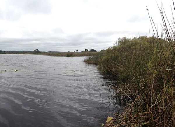
12. Northern Forest Canoe Trail
Length: 740 miles
Region: Northeastern United States
Endpoint 1: Old Forge, New York
Endpoint 2: Fort Kent, ME
The Northern Forest Canoe Trail is a rolling, serene, shallow, narrow, deep and broad, which follows a challenging route across five major watersheds. These comprise of 79 rivers, lakes, streams and ponds, spread across four states and a small portion of Quebec. Many sections of the trail are characterized by beaver dams, hydro dams, rock gardens, falls and oxbows. The trail’s variety of swift water, whitewater and flat water, on a range of streams, rivers, ponds and lakes, provide remarkable opportunities for kayak and canoe recreation. Friendly communities along the way provide camping facilities and inns, together with other heritage and recreational attractions. In Maine, you will find the Rangeley Lakes, which are huge and surrounded by mountains and conserved forests. There is also the southern section of the Dead River, which provides enough water for whitewater paddling. Spencer Lake and nearby streams are scenic and remote. The Allagash Wilderness Waterway is a stunning array of lakes, rivers, streams and ponds, meandering through northern Maine. If you love hiking and water sports, the Northern Forest Canoe Trail is your preferred summer vacation.
13. Finger Lakes Trail
Length: 557 miles
Region: New York
Endpoint 1: Catskills
Endpoint 2: Western New York
Start your hiking day with a backpack over your shoulders and sunlight cascading through the trees, to get a real experience of natural beauty of the Finger Lakes Trail. The trail is deceptively simple, especially when you look at the map. Most people will argue that there is nothing much to see, apart from the rolling hills. Others will tell you that upstate New York is not fit for outdoor adventure, and that is exactly the point. The Finger Lakes Trail offers solitude and wilderness at a time of the year when both are tricky to find. Explore close to eight New York state parks along the trail, which spans a wide range of terrains such as cascading waterfalls, beautiful gorges, and wildlife. There is a variety of camping facilities and amenities to use. You can even sleep under the stars, and enjoy the cool, fresh air the forests have to offer. How often do you experience this? Enjoy the beauty of the state parks and witness the spring run of rainbow trout, throughout Watkins Glen State Park. Clear views, snow-covered paths, and the solitude of the woods, there is something special about hiking the Finger Lakes Trail during winter. Enjoy the budding greenery during spring and rise with the sun for a summer hiking adventure. Nothing beats the feeling of getting outside and enjoying the mild days, foliage, the most beautiful days along the trail, during fall. Whichever season you choose to go for the hike, you are assured of maximum fun and adventure.
14. Bay Area Ridge Trail
Length: 500 miles
Region: San Francisco Bay Area
Endpoint 1: Arguello Gate
Endpoint 2: Golden Gate Bridge
This charming trail offers natural wonders, seclusion, and cultural and historic variety of the entire region. There is a lot packed along the trail. In fact, it might be the best trail for those looking for variety, since there is so much to see along the way. You will encounter the Presidio forest, historic and cultural points, three scenic overlooks, and 100-foot sculpture, created from felled Monterey cypress trunks. It is a treasure for visitors and residents alike, offering easy access to some of the most beautiful views in the San Francisco Bay Area. You can enjoy expansive and spectacular views of the Pacific coastline, city skylines, mountain ranges, as you cross diverse landscapes of open grasslands, towering redwoods, wildflower-covered meadows, coastal bluffs and the dense California forests. When the entire trail is complete, it will connect more than 75 parks as well as open spaces.
15. San Francisco Bay Trail
Length: 500 miles
Region: San Francisco Bay Area
Endpoint 1: San Francisco Bay Area
Endpoint 2: San Francisco Bay Area
With over 500 miles, the San Francisco Bay Trail connects communities to open spaces, parks, schools and transits to each other. Since the trail traverses the whole of San Francisco Bay, there is a wide variety of landscapes and views to experience. If you are looking for a bustling scene, just take a walk along the Embarcadero in San Francisco on a sunny afternoon. On the other hand, if you are looking for solitude and peace, only interrupted by windswept grasses and chirping of birds, head over to the Tubbs Island Trail, which is located on the shores of San Pablo Bay. Apart from hikers, photographers, bird watchers, skaters, picnickers and wheelchair riders, also use this trail. The trail is incredibly diverse, featuring peaceful stretches along the Don Edwards San Francisco Bay National Wildlife Refuge. The trail also comes with several bridges flung over San Francisco Bay. The bridges provide the perfect opportunity to absorb the sweeping water views.
16. Colorado Trail
Length: 483 miles
Region: Central Colorado
Endpoint 1: Waterton Canyon southwest of Denver
Endpoint 2: Durango
The Colorado trail is among the first long distance hiking and bikepacking trails in the US. It cuts through the scenic Colorado Rocky Mountains, amongst glacial lakes, creeks, peaks and a magnificent array of ecosystems. This trail flows through six wilderness areas, eight mountain ranges, five major river systems, as well as six National Forests. Although it is very popular with bikers, bikes are not allowed in the wilderness areas. If you are a thru-hiker, you will have all the peace mind and solitude you need, as you traverse the wilderness areas. The time taken for a thru-hike depends on various factors, including the course modifications, trail management, and weather conditions, just to name a few. An average hiker can complete the trail in 5 weeks while mountain bikers can hammer it out in less than 14 days. Travelling from Denver to Durango is preferred due to snow. The snowpacks on the high mountains in the east tend to melt off earlier. By the time you hit the western region, most of the snow has melted, making the trail passable. The whole trail is divided into 28 segments, which makes it easier to cover them. You can hike most of the segments within a day.
17. Oregon Skyline Trail
Length: 428 miles
Region: Oregon
Endpoint 1: Washington State
Endpoint 2: California
Go down memory lane as you hike along the Oregon Skyline Trail. Established in 1920, the Oregon Skyline Trail is your passport to enjoy nature, history, culture and adventure. Located in one of the most remote areas on earth, you can hike on any season of the year, depending on your preferences. This trail, which is almost a century old, traverses nine wilderness areas, Cascade Siskiyou National Monument and Crater Lake National Park. It is a combination of rough mountain trail and road. As you hike through the trail, you will notice that the sections are not uniform, since they were built at different times by different people including trappers, stockmen, Indians and miners. Most stretches have been rerouted while some of the older sections are currently considered as alternate paths to the Pacific Crest Trail. Large sections of the trail have been relocated to align with the backbone of mountains. This gives hikers more scenic views.
18. Palmetto Trail
Length: 425 miles
Region: South Carolina
Endpoint 1: Charleston
Endpoint 2: Southern Appalachians
Imagine hiking across 500 miles through forests, mountain ridges across swamps and into big towns. The Palmetto trail will take you from the mountain to the sea. Across changing landscapes, views, flora and fauna, this trail connects state and county parks, nature preserves, natural forests, wildlife management areas, Native American paths, Revolutionary war battlefields, urban to rural, maritime to sandhills, swamps to mountains, and many more. The Palmetto Trail Pale Ale gives you another reason why you need to explore this trail. This ale is a special blend of malt and hops, formulated to quench your thirst after a trail trek. If you are passionate about the character and diverse beauty of South Carolina, then you will enjoy trekking across the Palmetto Trail. You are hiking because it is something you love, and the Palmetto Trail is one of the most scenic in the country. Don’t focus too much on your daily mileage quota. This is a chance to enjoy your surroundings, lay in cold springs, sleep under massive rocks and have fun your days.
19. Bigfoot Trail

Length: 400 miles
Region: Northwest Carolina
Endpoint 1: Klamath Mountains of northwest California
Endpoint 2: Redwood National Park
Hike your way into the land of myth and biodiversity, along the Bigfoot Trail in Northwest Carolina. The remote Klamath-Siskiyou Mountains are a source of all things crypto-hominid, from specialty Bigfoot traps to supposed sightings, to town jamborees, which celebrate the myth of half-ape, half-man. As you can see, there is so much to explore along the way. Every day on the Bigfoot Trail brings a new experience. There are no dull days. You now understand why Michael Kauffmann decided to create that hiking trail through those mountains. As for the name, Bigfoot is the symbol of the Klamath Mountains, and it creates some buzz on the trail, right? Although Sasquatch is what attracts many people to the region, there is more for your eyes. You will love the remarkable diversity of trees and plants in these mountain ranges, which are among the oldest in North America. The route connects three national forests, six mountain areas, and a national park. The route is home to around 32 conifer species as well as over 3500 plant species. The trail also connects famous destinations like Trinity Alps, Jedediah Smith Redwoods State Park and Marble Mountains.
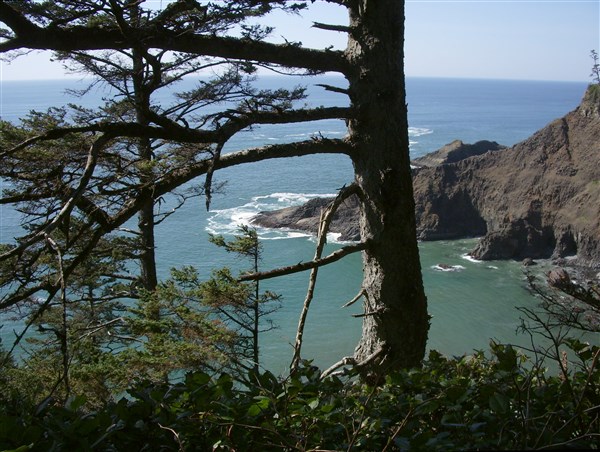
20. Oregon Coast Trail
Length: 362 miles
Region: Oregon
Endpoint 1: North Oregon Coast at South Jetty
Endpoint 2: Brookings
Explore the majesty and sheer beauty of Oregon’s coastline as it unfolds along this coast trail. As you hike on this trail, you will cross sandy beaches, traverse majestic headlands and meander through forest corridors, as you soak in fresh air and enjoy the peace and tranquility that nature provides. Although a large section of the route is on the beach, you still get the opportunity to cross state parks. The Oregon Coast Trail is your gateway to the entire pacific edge, which opens sea stacks, rainforests and beaches. You also get the opportunity to grab some ice cream on the shoreline towns along the way. This trail, which is easily accessible from different locations, is the perfect balance of scenery, convenience and wild adventure. You will climb through alder and rainforests and enjoy the beauty of spruce and hemlock forests. Catch gorgeous ocean views and the beauty of sunset. It doesn’t feel like a hike at all but more of a beach vacation. Explore the Neahkahnie Mountain and get amazing views of Manzanita. This trail was designed and developed to explore the splendor of this beautiful coastline.
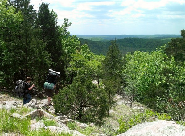
21. Ozark Trail
Length: 350 miles
Region: Missouri
Endpoint 1: St. Louis southwest
Endpoint 2: Arkansas border
If you are planning a hiking and backpacking trip and you are yet to decide on the best location, then look no further. The Ozark Trail is the perfect blend between breathtaking scenery and challenging adventure. It meanders through the beautiful region of Missouri as you hike some of the highest mountains in the region, including the St. Francois Mountain. At the top of St. Francois Mountain, the views below are worth the effort. It is something out of this world. The trail traverses through dense oak, hickory and pine forests, with shady, deep hollows as well as windswept ridges. Carry your waterproof hiking boots because you will cross several wet weather streams along the way such as Trace Creek and Hazel Creek. There is no shortage of water in most sections of the trail while camping facilities are in abundance. The Karkaghne Section of the Ozark Trail provides great swimming opportunities, allowing you to cool the body from the hot summer temperatures. As you cut through the Blair Creek Section of the Ozark Trail, old home sites, springs as well as fields full of wildflowers. The last section of the trail offers scenic vistas, ranging from the highest waterfall in the state to panoramic glades. Complete your hike swimming in one of the best natural pools around.
22. Long Path

Length: 347 miles
Region: New York + New Jersey
Endpoint 1: George Washington Bridge in Fort Lee, New Jersey
Endpoint 2: Altamont, New York (Albany)
Despite being a close cousin of the Appalachian Trail, the Long Path is unknown to many people. Unlike the Appalachian Trail that is full of traffic during the hiking season, you will experience solitude and peace of mind along the Long Path. The entire trail is filled with aqua blazes. It connects with many forest preserves and state parks in New York. The greatest thing about this trail is that it takes you to various parts of the state you might not know about, such as the Schoharie Valley. This is a complete mystery to many people but such an unbelievable natural beauty. The path commences at the George Washington Bridge, giving you stunning views of the Hudson River, Yonkers and New York City. Venture into Rockland county and connect with some of the most beautiful natural areas that include the Harriman State Park, Hudson Palisades, Schunemunk Mountain, the Catskills and the Shawangunk Mountains. Towards the end, you will ascend the Vroman’s Nose, which is a peak nested 600 feet above. It rewards you with a million-dollar view of the rolling farmlands below.
23. Midstate Trail
Length: 92 miles
Region: Massachusetts
Endpoint 1: Rhode Island
Endpoint 2: Wapack Trail in New Hampshire
If you are a harried city dweller, there is something mysterious and alluring about a trail that seems to go into the world of unknown. The Midstate Trail offers a perfect escape from all the noise and pollution of the city, to the quietness and serenity of the wild. It is easy to hike, highly accessible and the best way to bond with nature and get in touch with yourself. If you are not a long distance hiker, but you still love spending some nights in the woods, this trail is the one for you. Despite its close proximity to large population centers, it is remarkably scenic and wild. Most of the trail is on game lands, parks and state forests. Some sections of the trail are open to hunting. Therefore, you can combine your hike with some hunting, and enjoy game meat. You know it’s never that serious. Don’t forget to wear blaze orange if you intend to incorporate hunting into your hike.
24. Superior Hiking Trail
Length: 296 miles
Region: Minnesota
Endpoint 1: Jay Cooke State Park
Endpoint 2: 270 Degree Overlook at the Canada–US border
In northeastern Minnesota, lies the Superior Hiking Trail. Named after Lake Superior, the world’s largest freshwater lake, it traverses beautiful vistas and rugged landscapes, to give you a memorable experience. The more scenic sections of the trail start north of Duluth. This is where the trail takes you through the amazing Gooseberry Falls Park, giving you stunning views. From here, it returns to the shores of Lake Superior, with vistas showcasing rocky outcrops, ocean-like horizon and a blanket of dense rain forests. The Duluth section of the trail also gives access to Hawk Ridge. This is an area where over 90,000 raptors fly overhead each year. The landscape changes dramatically throughout the trail. The lowest section is around 600 feet above sea level while the highest point is just over 1,800 above sea level. It is not surprising that people come from all over the country to hike the Superior Hiking Trail. Whether you spend an entire summer backpacking or just a weekend trip, backpacking on this trail provides an unforgettable epic adventure.
25. Long Trail
Length: 272 miles
Region: Vermont
Endpoint 1: Massachusetts
Endpoint 2: Canada
Known as the oldest long distance hiking trail in the United States, the Long Trail is muddy and rocky, thus not for the faint-hearted. With over 185 miles of side trails, 272 miles of footpath, and up to 70 backcountry campsites, the Long Trail offers endless opportunities for the weekend overnighter, the day hiker, and the extended backpacker. It crosses some of the highest peaks in Vermont. Therefore, ensure you bring along some warm gear. Although it is known as a footpath in the wilderness, it’s character is more of backcountry. It climbs rugged peaks, passes alpine sedge, pristine ponds, swift streams and hardwood forests. It is muddy in others, steep in places and rugged in most. Experts and novices alike will enjoy the variations in terrain along this trail. The Long Trail is the best way to bring the mountains closer to you.
26. Tuscarora Trail

Length: 252 miles
Region: Appalachians
Endpoint 1: Matthews Arm, Shenandoah National Park
Endpoint 2: Blue Mountain, Appalachian Trail
Originally created as an offshoot of the Appalachian Trail, the Tuscarora Trail mainly travels along ridge tops, giving spectacular views of lands below. It was mainly built as an alternative route to the Appalachian Trail, in a wilder corridor, since it was feared that commercial development would force closure of the AT. As it travels through 4 states, it provides serious backpacking opportunities, especially for the experienced hiker. It is mainly used for walking, hiking, birding and nature trips. Watch the hawks and the vultures ride the thermals as you enjoy your lunch. The highest point is approximately 1600 feet while the lowest point on the trail is around 826 feet. Most sections of the trail are rocky. However, it offers good views especially to the south.
27. Katy Trail State Park
Length: 240 miles
Region: Missouri
Endpoint 1: Machens near St. Louis
Endpoint 2: Clintons
If you are a nature lover, bicyclist, history buff or hiker, you will fall in love with Katy Trail State Park. It offers an opportunity of exploring Missouri’s rich history and natural beauty, all year round. This long distance hiking and biking trail welcomes people of all ages to explore and discover the beauty of Missouri. It is the rail trail Hall of Fame, a designated Millennium Legacy Trail, and part of the American Discovery Trail. Large sections of the trail follow the great Missouri river, offering scenes of natural beauty. The Katy Trail State park offers outdoor lovers a safe pathway to enjoy the quiet and peace of the state’s landscape. The crushed limestone, hard-packed surface is fairly constant and level as it winds through the countryside. With more than 30 trailheads along the route, the trail is easy to reach throughout the year. It also offers access to numerous award-winning wineries, including Augusta, Defiance, Hermann, Dutzow and Rocheport. Regardless of the season or time of the year, the scenery along this trail is always beautiful and enjoyable. With a wide range of panoramas, from sandstone bluffs to rainforests, gently rolling farmlands, sweeping river views and wetlands, you are assured of enjoying your trip, no matter the length. Don’t forget to bring your camera, because you never know what you might encounter!
28. New England National Scenic Trail
Length: 233 miles
Region: Connecticut and Massachusetts
Endpoint 1: Guilford, Connecticut
Endpoint 2: New Hampshire border
If you plan to hike the National Park Season, fall is one of the best seasons. The bright colors and the color days provide lots of incentive and plenty of motivation to hike. Such a wonderful hiking season calls for a wonderful and scenic hiking trail. That trail is none other than the New England National Scenic Trail. It is quite hard to find a place that beats New England when it comes to hiking. The yellow, amber, red and orange leaves, cover the hardwood forests. Follow this trail and it will open the wonders of the southern areas of New England. As you head from Long Island, you will view scenic mountain summits in Massachusetts and Connecticut. It features a cultural and natural landscape of mountain ridges and summits, colonial historic landmarks, farmlands, historic village centers, quiet streams, unregimented forests, steep river valleys and undulating waterfalls.
29. Ouachita National Recreation Trail
Length: 223 miles
Region: Arkansas and Oklahoma
Endpoint 1: Talimena State Park, Oklahoma
Endpoint 2: Pinnacle Mountain State Park
From roller coaster, boulder-strewn ridges, in Talimena State Park, to Pinnacle Mountain State Park, this recreation trail brings to you sheer beauty and magical landscapes. Varieties of huckleberries-blueberries are dotted along the way. The trail is mainly used by backpackers, hikers, mountain bikers and hunters. Due to the southern latitude and its low elevations, the best time to hike the Ouachita National Recreation Trail, late autumn and early spring. You can also hike during the winter months, since they are warm enough. From July to September, temperatures are particularly high, which makes hiking quite uncomfortable. Water points also dry up during these months. There are numerous shelters along the trail, which makes it camping-friendly. The higher elevations are characterized by strong and cool southern winds sweeping through. Wildlife is abundant throughout the trail, including white-tailed deers, an occasional black bear and numerous varieties of birds.
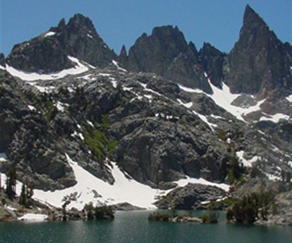
30. John Muir Trail

Length: 211 miles
Region: California Sierra Nevada
Endpoint 1: Yosemite Valley
Endpoint 2: Mount Whitney
Hiking the legendary John Muir Trail (JMT) is like winning the lottery. Seriously, it is. The entire trail extends through the wonderful backcountry of the High Sierras. If that statement alone is not enough to coax you to head to California, what about the pristine waters, the host springs and the epic swim spots? When hiking the JMT, you don’t need to carry more than 2 liters of water. There is plenty along the way. In fact, most of the water along the trail does not need to be treated. However, you may think otherwise when you watch a mule relieving himself directly into a creek. Thanks to a combination of nighttime temperatures and snowmelt, you can swim at any time in these waters. Just choose your favorite spot and jump in, after a long, treacherous day on the trail. If cold scares you, there are numerous hot springs close to the JMT. As for the landscape itself, you will marvel at its jaw-dropping beauty. Ranked 3rd by the National Geographic among the Top Ten Most Visited National Parks, Yosemite attracts close to 4 million visitors per year. Each day is more beautiful than the other. The landscapes change every time, from raging rivers to arid deserts, to aquamarine lakes, to towering mountains, to lush wildflowers and rocky slabs. One day you are walking in a world covered in snow while the following day you wake up a bright sunny day with blue skies. It is quite hard to find words the perfectly describe the experience and hiking adventure on the JMT.
31. Bay Circuit Trail
Length: 200 miles
Region: Massachusetts
Endpoint 1: Newbury
Endpoint 2: Kingston
A diversity of cultural and natural sites, combined with gentle terrain make the Bay Circuit Trail a fun adventure for hikers of different abilities. It connects various conservation areas, state parks and historic areas. Although some people would argue that the route is not remote backcountry, most of it passes through land that is very beautiful, filled with grasslands, wetlands and forests. There are many hills to climb, which makes it quite challenging to hike in both the cold and the winter sunshine. Some of the landmarks that you will encounter along the trail include, Henry David Thoreau’s Walden Pond, the Charles River, Great Meadows National Wildlife Refuge, Massachusetts Audubon’s Moose Hill Wildlife Sanctuary, Lowell National Historic Park and the Merrimack River, just to name a few.
32. Cowboy Trail
Length: 195 miles
Region: Northern Nebraska
Endpoint 1: Norfolk, Nebraska
Endpoint 2: Valentine, Nebraska
If you haven’t been on Cowboy Trail, then you are yet to see the wonderful Nebraska scenery. It is the first recreational trail in Nebraska, where equestrians and hikers may bond with nature and enjoy the solitude of the wild. With close to the 30 communities along the trail, the trail promises lots of historical and cultural diversity. It stretches for almost 200 miles, traversing some of the most intriguing landscapes in the Midwest, featuring farmsteads, prairie lands, forests, river valleys and some of the largest sand-covered dunes in the western hemisphere. Although the trail is more common with bikers than hikers, hiking the trail provides nature lovers with a unique adventure that can only be found in Nebraska. The entire trail features more than 200 bridges, providing great spots for photo opportunities. The bridges offer some memorable and stunning views along the trail. Are you planning a multi-day hike? There are several camping spots and towns along the route. Some towns even provide facilities like showers and restrooms for trail users.
33. Sierra High Route
Length: 195 miles
Region: California
Endpoint 1: Cedar Grove
Endpoint 2: Twin Lakes
If you are looking for a true sense of adventure, long stretches of solitude and pristine alpine settings, then you need to head over to the Sierra High Route during the hiking season. With over 33 passes and Alaska-sized scenery, this trail offers just the right risk to keep the journey interesting. If you have been thinking that you can’t find life-changing adventure in the Lower 48, then you need to think again. Just beneath Yosemite’s nose is a rugged and extra-burly route, which will give you more than you bargained for, more solitude, more scenery and more clench-fisting risk. Every inch on the trail is achingly beautiful. There are no lost moments on this trail. Every mile has something memorable to remember and push you to the next one. You will encounter flower-filled meadows, clear streams of water, skyscraping cirques, and a perfect filter for civilization pollution. In these modern hiking times, 200 miles might not seem like a deal-breaker. However, this route is the real deal. This is some big and bad wilderness. It is the type that of trail that scares away amateurs on the first day. If you think that trails don’t provide enough challenge or they are too restricting, the SHR will be worth checking out.
34. Chesapeake and Ohio Canal

Length: 185 miles
Region: Washington, D.C
Endpoint 1: Washington, D.C
Endpoint 2: Cumberland, M.D
Established more than a century ago, the towpath was mainly used by boats transporting products along the canal. The boats were towed using ropes, which were harnessed by mules, which walked along the towpath on the canal. Although various parts of the canal are filled with water, the whole towpath still exists. It is a favorite among hikers, cyclists and joggers. History aside, the towpath runs along the Allegheny Plateau, cutting through the Appalachian Mountains, then descending to the Piedmont. It then passes the remarkable Great Falls of the Potomac, before descending further to the mouth of Rock Creek. As you might have noticed, the whole path is a delight to see. Much of the route is secluded and serene. Unlike other trails, you will not encounter much traffic along the way, apart from the occasional hikers and cyclists. Every few miles, you will encounter parallel stonewalls, which acted as locks stands when the canal was operational. Choose your own journey and enjoy what the Chesapeake and Ohio Canal has to offer.
35. Tahoe-Yosemite Trail
Length: 180 miles
Region: California
Endpoint 1:Tuolumne Meadows in Yosemite
Endpoint 2: Lake Tahoe
Although it’s not an official trail such as the Appalachian Trail or the Crest Trail, the TYT also has much to offer for adventure seekers. It is composed of two cross-country routes, one that rises above 10,000 feet, through meadows, rainforests and snow-peaked mountains. If you are just starting out, use the easier northern most routes. The alternative route tends to be more difficult, due to the breathing difficulties presented by the high elevation. As it passes through four designated wilderness areas and one national park, adventure seekers will come across snow-capped mountain peaks, beautiful lakes, white granite mountains, deep canyons, and various types of meadows and forests. As the trail ranges from 5,000 feet to 10,000 feet, you may need to carry an oxygen pack! The best time to hike the TYT is June, through to October. During the summer, there is more daylight for hiking, water sources are flowing and the wildflowers are in full bloom. You can also hike during fall when there is less traffic and the water fords are low.
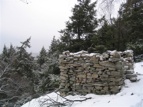
36. Justin P. Wilson Cumberland Trail State Park
Length: 300 miles
Region: Tennessee
Endpoint 1: Cumberland Gap National Historical Park
Endpoint 2: Chickamauga and Chattanooga National Military Park
Traversing two time zones and 11 counties, the Justin P. Wilson Cumberland Trail State Park is your pathway to scenic beauty. It is the only linear park in the state, giving hikers access to some areas preserved for their scenic and natural beauty that cannot be found elsewhere. This scenic trail follows several sparsely populated ridgelines. The trail has been strategically routed to give spectacular views and sparse drinking water sources. This very rugged and very scenic trail gives you the peace of mind that you deserve, after a tough week. It dips into spectacular gorges, giving you a chance to enjoy beautiful swimming holes and scenic waterfalls. A trail designed by hikers for hikers, you have no doubt that your experience will be worthwhile. It is built to minimize environmental impact and maximize on your adventure. As a country hiking trail, you will experience scenic overlooks, numerous picturesque waterfalls, as well as a wilderness experience that is quite rare in eastern U.S.
37. Tahoe Rim Trail
Length: 165 miles
Region: California + Nevada
Endpoint 1: Lake Tahoe Basin
Endpoint 2: Lake Tahoe Basin
This 165-mile hike is arguably one of the most charming and accessible thru-hikes in this part of the country. From glacially carved valleys to volcanic rock formations to lush meadows filled with wild flowers, not to mention the picturesque alpine lakes and the dense rainforests. The sheer amount of microclimates and landscapes makes this trail one of the most gorgeous in Northern California, and the neighboring regions. This spectacular loop takes you through fields of thigh-high lupine, through the quiet of fir, past sparkling granite and quiet lakes. The circumnavigation of the lake itself is enough to challenge both the experienced backpackers and the new hikers. The good thing about the course is that it is suitable for all levels of hiking. It is a balanced introductory trail. This 15-day backpacking trip offers the hiker sufficient time to be immersed into the world of thru hiking. In addition, it is short enough making it achievable for first time long-distance hikers. Large swathes of Mule’s Ear fill the backcountry hillsides along the Lake.
38. Bartram Trail
Length: 153 miles
Region: Southeast Mountains
Endpoint 1: Chattooga River
Endpoint 2: Cheoah Bald
From Chatooga River to Cheoah Bald, Bartram Trail takes you through a world of nature-filled adventure and gorgeous views. It is one of the sweetest pine-carpeted hiking trails in the country. You will experience the wonders of Thurmond Lake shores as you explore the Georgia forests and Savannah River. The continually changing landscape is one of its outstanding features. Shortleaf pine and loblolly can be found at the higher elevations. There are numerous types of hardwoods visible that include: yellow poplar, red gum, black gum and several species of hickory and oak. Nature lovers will enjoy the wide variety of game and non-game wildlife species. The forest is home to turkey, white-tailed deer, rabbits, quails, and squirrels. Songbirds are also numerous, as their sweet songs keep you company in the woods. Bald eagles soar above, just to reassure you that everything is fine. The natural beauty of this area, especially along the shore will keep you coming back.
39. Great Allegheny Passage
Length: 150 miles
Region: Northeast
Endpoint 1: Cumberland
Endpoint 2: Pittsburgh, PA
Designated as a hiking and biking trail, the Great Allegheny Passage provides more than 150 miles for everyone who wants to blend breathtaking scenery and adventure. It is a journey through the region’s rich history, which has been preserved for many generations. Built during the days when coal reigned supreme, this rail trail used to be very busy with heavy freight trains. It was a key element of commerce in the region. Since rail traffic requires gentle grades, hikers along this passage will never encounter inclines greater than 1%. A gentle course allows you to enjoy nature at your own pace. Outdoorsmen enjoy a virtually-flat and smooth pathway, meandering through picturesque peaks as it traverses sparkling streams, fertile pastures, river gorges and tunnels under the tall Pennsylvania mountains. It is truly one of the most scenic trails in Pennsylvania. Based on the time of the year, you will be rewarded with sweetly-scented, gorgeous spring flowers, tufts of wild columbine, towering green forest stands, a silvery glint of frost and snow and a blaze of autumnal orange or red. The air is always clean and bracing and the experience is always unforgettable.
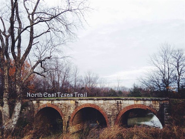
40. Northeast Texas Trail
Length: 132 miles
Region: Texas
Endpoint 1: Farmersville, Texas (NE of Dallas)
Endpoint 2: New Boston, Texas
Walking alone in the silence of the forest is always a good time to reflect and think about the important things in life. The Northeast Texas Trail provides you with that opportunity. It gives you the freedom of traversing the country on your own terms and at your own pace. It is rare to experience such a feeling, especially when you go back to the city where life is fast. As the wind whistles through the trees and birds wake you up in the morning, you feel reborn. It is a recreation treasure for Northeast Texas, although some sections of the trail are yet to be completed. However, that should not stop you from hiking along this trail. In fact, it gets more interesting and unpredictable. Although it is still a work in progress, it is possible to accomplish the entire trek, without worrying where the next meal will come from or whether you will find a hot shower and a comfortable bed. There is much to see along the trail, as it cuts across open countryside, away from traffic and roads and through natural preserves. It takes you through open farmlands, thick forests, brush land, over stunning bridges crossing creeks and rivers, and historic stretches of old railroad lines. It is a trip for the free spirits.
41. Metacomet Monadnock Trail
Length: 114 miles
Region: New Hampshire
Endpoint 1: Metacomet Trail on the Massachusetts-Connecticut state line
Endpoint 2: Mount Monadnock
When you tell people that it is possible to hike from Connecticut to New Hampshire, most will think it’s a joke. However, there is a 114-mile corridor that artfully cuts through elevated wild land, from northern Connecticut to Central Massachusetts. It finalizes on Mt. Monadnock, and you can look back and marvel at the beauty of nature. Although some sections pass through large population areas, the trail is remarkably scenic and rural. Without sounding like a professor, it features numerous areas of unique historic, geologic and ecologic interest. Some of the notable features on the course include dramatic cliff faces, waterfalls, woodlands, exposed mountain summits, lakes, swamps, farmlands, river floodplain, and significant historic sites. Don’t forget to carry your camera because there is so much to see as you hike along.
42. Hennepin Canal Parkway State Park

Length: 105 miles
Region: Northern Illinois
Endpoint 1: Bureau Junction, Illinois
Endpoint 2: Colona, Illinois
Do you want a peaceful, relaxing day of hiking, fishing, picnicking and family fun? The Hennepin Canal Parkway State Park might be your ideal destination. Constructed over 100 years ago, the canal played a key role in the US history. Its locks, waterway, aqueducts and the accompanying towpath, continue providing a beautiful recreational resource. The towpath provides more than 100 miles of biking and hiking fun. Some sections of the trail are open to snowmobiling and horse riding. Fishing along the canal is outstanding, while the hiking is easy and level all through. However, ensure you make several stops along the Hennepin, if you are hiking the entire length, to absorb the beauty offered by the canal and the surroundings. If you are looking for something more challenging, hike the 4.5-mile trek, which is located in the main complex. It is moderately difficult while giving you a general experience of the landscape, from grasslands to tall timber to marsh. Hiking on this course is particularly satisfying during fall.
43. Woods Line State Trail

Length: 105 miles
Region: Oregon
Endpoint 1: Klamath Falls
Endpoint 2: Dairy
Immerse yourself in the natural beauty and the fresh air of the Woods Line State Trail and its surroundings. This rail-to-trail conversion is used by joggers, walkers, cyclists and equestrians, all seeking to have a peaceful time in the wild. As you start your journey at the OC&E Woods Line State, you will experience stunning views of Poe Valley, Mount Shasta, and Lost River. From Olene to Dairy, the section of the trail is more rural with less traffic. If you want to soak in the scenery and enjoy the beauty of the surroundings, then you should not be in a hurry. Spend a few hours in every section and learn some history of the place. You will also see some wildlife along the trail, especially raptors, shrubland birds and some deer. There are also hot springs in the area. If you go hiking on a cold day, you will see rising steam.
44. Uinta Highline Trail
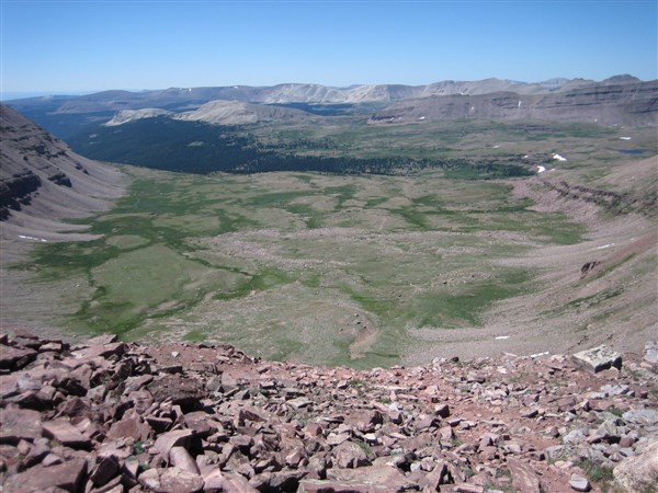
Length: 104 miles
Region: Utah
Endpoint 1: Hayden Pass, Utah Route 150
Endpoint 2: U.S. Route 191
Simply stated, this is one of the greatest mountain trails not only in Utah but in the whole nation as well. More than 70 miles of the trail are above 10,000 feet and above the timberline in most sections. Hikers are able to see the very best of subalpine and alpine Utah. You need to watch your step as you hike along because the rampant wildlife and the non-stop views are distractingly spectacular. You rarely hike more than a mile before you come across a herd of mountain goats, weasels, coyotes, and spotted elks. This trail also rewards you with views of every kind, from nearby wildlife to distant horizons, mountain peaks to isolated lake basins. The views are simply picturesque. Hiking over 10,000 feet, you get the perfect elevation to spy the 26 wilderness summits of Utah. It is estimated that there are more than 36 major streams and 1,000 lakes, which is quite unbelievable. Bring a camera and a fly rod. Capture the moments as you fish. You would be a fool to rush this hike. You would assume that with all this unobstructed scenic views, the place would be crowded. However, less than 50 people thru-hike this trail per year. Are you looking for a honeymoon plan? This looks like it.
45. Wonderland Trail
Length: 93 miles
Region: Washington
Endpoint 1: Mount Rainier National Park
Endpoint 2: Mount Rainier National Park
With every turn, this trail reveals cascading waterfalls, glaciers, lush rainforests, sub alpine meadows, rivers, canyons and lakes, all set to give provide you with a complete outdoor adventure. No two faces of Mount Rainier look alike. As you tackle different sections on the trail, each day is unique and provides different memories. When the trail is not ascending a ridge, it is descending a valley. The descents and the ascents make it a challenging hike, designed to test your endurance, strength, and durability of your hiking boots. There are a number of side hikes along the trail, which might tempt you to veer from the course. The best time to hike the Wonderland trail is between July and September. This is the warmest time of the year in these parts, the snow has cleared and the mountains tend to have less precipitation. The thrilling wildlife encounters, the suspension bridges, slippery snowfields, wildflowers galore, serene campsites and the stunning waterfalls, all make the hike worthwhile. It is a trip to remember for a long, long time. It is perfectly designed for you to enjoy the beauty of nature. Take as much time as possible on the trail to appreciate this amazing experience fully.
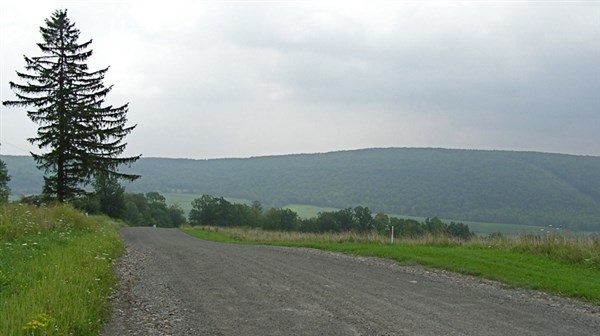
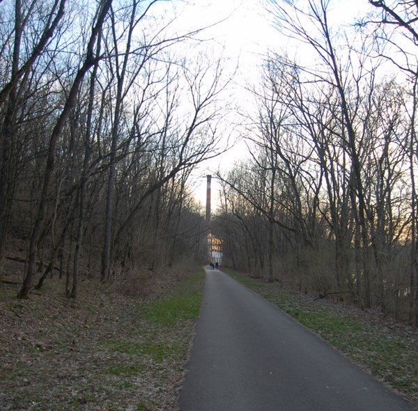
46. Great Western Trail
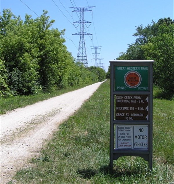
Length: 4455 miles
Region: Western Rockies
Endpoint 1: Canada
Endpoint 2: Mexico
Traversing over 4,000 miles, the Great Western Trail is one of the longest hiking trails in the US. It passes through 5 states, including Utah, Arizona, Idaho, Montana and Wyoming. In Arizona, the trail is at elevations of approximately 5,000 to 10,000 feet while temperatures remain high throughout the year. Apache fir, pinon trees, bristlecone pine and aspen abound. If you decide to extend your trip to the northern Colorado Plateau, you will encounter Ponderosa fir and Douglas fir. In northern Colorado, you will hike along Tablelands of approximately 7,000 feet. Summers are warm, winters are cold and there is plenty of rain and snow. In Jerome, you will come across some old mining towns, which ran obsolete when mining ended around the 1950s. These areas have since been converted to tourist destinations, where you can buy souvenirs for a family or friend. The trail meanders through forested mountains, sandy deserts and lots of challenging terrains. This keeps things interesting and lively. Most sections are open throughout the year.
47. Midstate Trail (Massachusetts)
Length: 92 miles
Region: Massachusetts
Endpoint 1: Rhode Island border
Endpoint 2: New Hampshire border
The Midstate Trail is a relatively moderate and beautiful trail, which runs straight across Massachusetts, dividing the state into western and eastern portions. Along the way, you will encounter Mount Watatic and Wachusett Mountain and numerous species of flora and fauna. Located just a few hours from Boston, the Midstate Trail is a great place for a weekend adventure or a day hike. Swamps, forests, rivers, cliff faces, dams and lakes – this trail offers a great variety of landscape and scenery for everyone to enjoy. Regardless of where you choose to start the trip, you are guaranteed ultimate fun and adventure at its best. You can break down the hike into a multi-day trip or a single-day hike, the adventure is all yours. If you are looking for New England adventure, you will definitely find what you have been looking for on this trail. Considering its distance, you will enjoy this trail for a significant amount of time, exploring the various landmarks in Massachusetts such as rock features, wildlife, valleys and hills. Soak in the sights and have fun.
48. Susquehannock Trail System

Length: 85 miles
Region: north central Pennsylvania
Endpoint 1: Susquehannock State Forest headquarters
Endpoint 2: Susquehannock State Forest headquarters
This 85-mile loop takes you through some of the most beautiful landscapes in Pennsylvania. It ends where it starts, which means that you can follow any course direction that you prefer. Located in Potter and Clinton Counties, the STS provides backpackers and hikers with a rugged trail featuring fire trails, pristine and virgin lands, isolated backcountry and endless trees. For the last 100 years, hundreds of streams and creeks have cut deeply into the Allegheny Plateau. Therefore, hiking on this trail involves huge descents into dark, hollow valleys. You then climb again to emerge on the sunlit forests above. The environment in this region, which is quite unique from what you encounter elsewhere provides some of the best hiking experiences. The STS represents the distilled spirit of backpacking in Pennsylvania. If you are a first time hiker, you will fall in love with the STS. It involves hiking over a wide range of terrains, from deep and verdant hollows, to stream valleys and high plateaus. Descents, climbs, wildlife and camaraderie, make this 85-mile trek a memorable one.
49. Foothills Trail
Length: 76 miles
Region: Appalachian foothills
Endpoint 1: Table Rock State Park
Endpoint 2: Oconee State Park
Whether you are planning a thru-hike or you are looking for a day-hike with friends, the Foothills Trail provides adventure of every difficulty and length. Apart from providing a superior hiking experience, the Foothills Trail also gives access to some of the most spectacular waterfalls for photographers and sightseers. Whichever direction you follow, this is an awesome trek. The best way to appreciate the numerous rivers, gorges, mountains and washes, is to hike from start to finish. The trail has numerous trailheads, which makes accessibility a breeze, in case of an emergency. Don’t rush your trip. There are numerous side trails worth your time. Relax and enjoy what nature has to offer. The waterfalls that fill the creeks and rivers are spectacular. Some of the highest falls in the southeast, including Laurel Fork and Whitewater Fork are found on this trail. There is always the sound of a flowing creek nearby, ready to quench your thirst and cool you down. From black-eyed Susan to pygmy pipes, to black bears and salamanders, you will encounter different types of flora and fauna. Whether it’s a fall or summer hike, the conditions are always welcoming.
50. Little Miami Scenic Trail
Length: 75 miles
Region: Miami Valley in Ohio
Endpoint 1: Springfield, Ohio
Endpoint 2: Newtown, Ohio
Despite the size that its name suggests, this trail is actually quite big. It is one of the most popular in Ohio, and the longest paved bikeway in the area. This hiking treasure connects five counties and various towns along the way. It passes through picturesque scenery, beautiful state parks, old and new bridges and the best of natural habitat. You will pass quaint eateries, canoe liveries, and modern attractions on Kings Island. Every moment along the trail is breathtaking. There is always a great experience waiting for you to unlock with your eyes. The trail follows the Little Miami River, which is tree-lined all through. It meanders serenely, through the picturesque countryside of Southwestern Ohio. This means that you can hike it all throughout the year.
[toc]
How To Hike These Trails Successfully?
Did you make it all the way to the end of the page? Hats off to you, my dear fellow hiking aficionado. You are now officially ready to take on an actual trail in real life. Be sure to take good hiking boots with you. Here we’ve got a men’s selection and a women’s selection. Your footwear is easily the most important hiking item that you can’t afford to forget about. The pages I linked to show the top 20 brands for hiking boots for both men and women. I think you’re going to have a great time trying to find the best ones for your hike of choice!
Now keep in mind… these are long distance trails. If you’re planning on making camp, you’ve gotta be sure to have a way of catching some zzz’s to make the most out of resting your eyes for a bit. A cot or a hammock can really help you out. If you want to sleep under cover, then you’re going to need a tent, either one for backpacking or for camping. Since resting alone isn’t going to keep you going on the trail, I highly recommend that you also find a way to make yourself some grub.
Naturally, you’re also going to have make sure you are properly dressed for the occasion. A good night’s rest and a full tummy are nice, but what’s it worth if you’re going to be suffering from rain and cold, all throughout your hike? For that reason, you’ve gotta be wearing a proper jacket. Depending on the weather situation you are expecting, you should either go with a jacket that is waterproof, or one made of down. Once your torso is properly clad, you stand a much better chance to enjoy your hike. But don’t forget to put on a decent pair of outdoor pants as well. Oh, and don’t forget your boxers!
You’d think you’d be properly equipped with all this, right? Well, we haven’t covered one very important thing yet, and that’s your pack. Depending on how long your hike is and what you want to take with you, you’ll need to either carry a daypack, a heavy duty backpack. And, depending on how gorgeous the scenery is that you’re going to be looking at, you also might want to consider to bring a bag to put your camera in. Last, but not least… the more strenuous your trail is, the more of a chance you stand of sustaining an injury. Small injuries such as scratches can still be really painful, despite being small. Don’t let injuries ruin your hike. Bring some first aid with you. You never know when it’ll come in handy!
Some people like to stray off the beaten path and go fish in the lake. If you’re planning on fishing while you’re camping lakeside, then you may want to bring a good kayak with you, that will keep you adrift while you’re keeping a close eye on your fishing float. And if you’re not just fishing for a little R&R, but you actually want to impress your wife… then consider bringing along a fish finder to really give yourself an edge!
Well… that’s it. I can’t think of anything more you’d want to bring along for a hike. Can you? What unmissable hiking item did I miss? Leave a comment or contact me, and let me know!
Navigation
[jbio template=”bootbomb0″]
These are fantastic. I’ve hiked on a few of these – Cumberland Trail in TN and the Chesapeake and Ohio towpath. The Pacific Coast Trail is definitely on my short list – it looks stunningly beautiful, and I’d love the chance to explore the west coast scenery.
Wow – these are some great hikes. I’m inspired to get out on a trail this summer.
Nice article, Brian. I added a link to this page on our Colorado Hikes page. Keep up the great work!
Great collection of hikes, definitely going to put some of these on my bucket list!
Thanks for this interesting site. I am now an armchair hiker because, I am 83, have terrible back problems, and a knee replacement. I have only hiked in the Sierra as it’s nearly my backyard. Did 1/2 the Tahoe Yosemite with my sister and niece, her late husband joined for part of it, from Carson pass to Clark’s fork on the Stanislaus. Have hiked in Carson Wilderness, Emigrant Wilderness, and Southern Yosemite.
I advise all trail lovers to not let life get in the way. I miss it very much so suggest you don’t hesitate. The trails don’t wear out but we do.
Happy hiking, Barb
Hi Barbara,
Truer words have never been spoken before on the Boot Bomb.
I can tell there’s a lot of experience and wisdom backing them up.
We’d all best take heed of your sage advice before it’s too late.
It’s the ultimate hiker’s dilemma.
So many trails, so little time…
Sincerely,
Brian
Suggested addition – Northville Placid Trail in New York. Its a 138 mile wilderness experience through some of the most beautiful sections of the Aidrondacks. http://www.nptrail.org/
Hi Chris,
That one looks gorgeous. Gotta remind myself to check it out in detail sometime!
Brian
Would also like to mention the Erie Canal Trail which currently runs 360+ mi from Buffalo, NY to Albany, NY. It goes through many small towns and villages, and several long portions of it are paved, making it suitable for hiking and cycling.
Hi John,
Thanks for letting me know. I’ve checked out some photos on google images. Looks really nice!
Sincerely,
Brian
The section of the Wind RIver Mountains (Continental Divide Trail) is unbelievable, breathtaking. To take it all in prepare to hike for 3 to 5 days. You can access from Elkhart Trailhead, the Upper Green RIver Lakes trailhead, or from Big Sandy Trailhead.
Hi HP,
Yes, it sure is breathtaking. But then again, all 50 hikes on this list are, IMO.
How many times have you hiked the Wind River Mountains?
Sincerely,
Brian
Your photo of the Great Western Trail (#46) shows the Great Western Rail Trail in DuPage County, Illinois. No mountains there!
Hi Jeff,
The current image doesn’t show any mountains. I’m not sure I understand your point. Feel free to clarify.
Sincerely,
Brian
Hi Brian…I didn’t see the AZT on your list…and I may have missed it. Do you have an opinion about it? Thinking of doing it next. Do appreciate your work on this list project. My thanks, VA
(Venerable Ancestor)
Hi Venerable Ancestor,
I love the Arizona Trail. It looks just like Red Dead Redemption 2. Although I think the Arizona Trail was probably first, so I should say RDR looks like AZT.
But I stray…
This is a list that was sorted by their length, descendingly, and cut off at 50. Arizona Trail didn’t make it on here. Nothing personal. Great trail. Just not in the top 50 longest ones!
Sincerely,
Brian
If you have big plans and want to walk coast to coast the American Discovery Trail (discoverytrail.org) incorporates quite a few of these trails.
Hi Bob,
Thanks for pointing that out.
I checked out your site. You should put way more and bigger pictures on there, man. Great opportunity to show the trail off!
Sincerely,
Brian
where mention of Arizona trail and grand enchantment trail?
What?
Hey John, I reviewed these trails and there are definitely several that I want to hike. There is one that was not on the list and I was wondering if you could do a review on it. It is the Pinhote Trail that begins at Flagg Mountain, AL and runs northeast to the Benton MacKaye trail, seventy miles west of Springer Mountain and the Appalachian Trail in north Georgia. Thank you for your articles on hiking in America.
Happy Trails
Joe Colotario
Hi Joe,
The name’s Brian, but that’s alright!
And I’m sure you mean the Pinhoti Trail. I’ve never been there myself, but I’m just now googling some images on it. It looks really sweet.
I’d love to add it to my reviews some time. Thanks for the suggestion!
Sincerely,
Brian
There are two Mid State Trails, and while I think you did mean to include them both, the info for the first one (#23) describes the MA MST, while the photo is from the PA MST. The PA MST is much longer, which at 327 miles would fit nicely between the Long Path and the Superior Hiking Trail.
Nice list though!
Hi Erix,
Thanks for letting me know. I’ll see if I can get that sorted soon.
Sincerely,
Brian