
Feel like going on a hike in Switzerland? The Graubünden canton offers adventure high and low. The nation’s largest and most sparsely populated canton covers scenic territory and in an area over 2,700 miles wide — from valleys to mountain peaks. Bordering on Italy and Austria, Graubünden is where you’ll find the only national park as well as the upscale ski resorts of St Moritz, Davos, Klosters and Arosa, all areas great for hiking. Inhabited since 3000 BC and rich with history, the canton is officially trilingual, divided between German, Romansh and Italian.
Ticino (pronounced Ticheeno), located on the southern slope of the Alps bordering Italy, is the Italian speaking canton and different from the rest of the country in virtually every way. Known as the “sunny room” of Switzerland, the climate is balmy and you can actually see palm trees at the shore of Lake Maggiore and Lake Lugano. Relying heavily on tourism for income, Ticino is well linked to the rest of Switzerland by tunnels accommodating both rail and road. Rich with geography, nature and culture, Ticino provides a unique and special way to enjoy hiking in Switzerland.
Hiking In Switzerland’s Southern Regions
Davos (Graubünden)
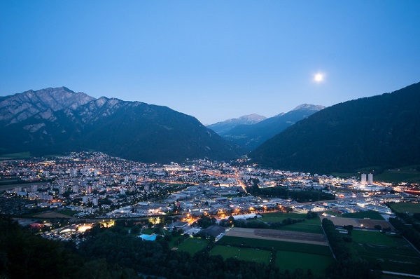
Celebrated as both a ski and health resort, Davos is a larger town with a population exceeding 10,000. Located near Klosters, another popular ski resort, Davos is divided into two parts: Davos Platz (Center) and Davos Dorf (Village). Despite the fact that hotels, restaurants and shops abound throughout the region, it has more of a homey than ‘touristy’ feel. Though buses and trains run infrequently in the region, it’s an excellent base for a good hike. And, for those who want to experience a bit of glitz, the famed area of St. Moritz is easily reachable.
Engadine Valley (Graubünden)
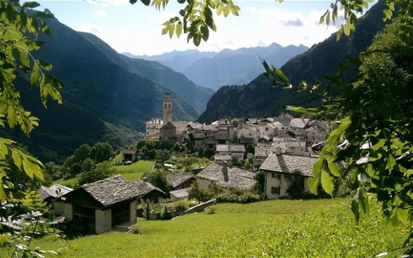
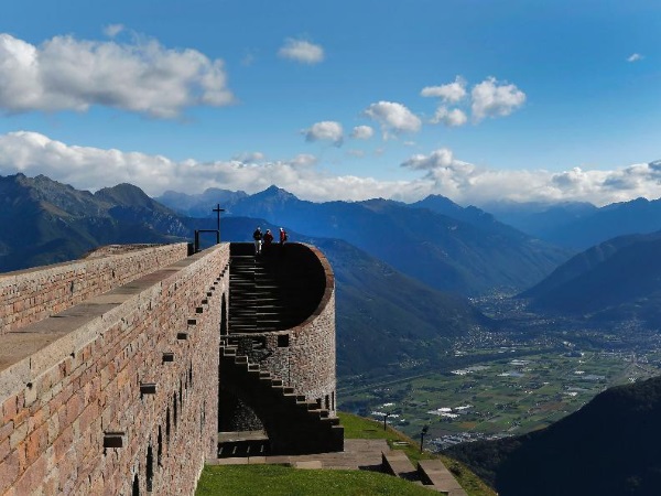
Though best known for fashionable St. Moritz, there is much more to the Engadine Valley to make your Swiss hike pleasurable. Stretching from the Austrian border in the north to Zernez and the National Park in the center to St. Moritz in the south, the Engadine valley includes the charming little villages of Celerina, Pontresina, Silvaplana, Surlej, Sils Maria, Samedan, Maloja, La Punt, Zuoz and Champfer. If you travel by car you could take a daytrip to cross the border to Italy over the Pass del Bernina, to the lovely little town of Poschiavo. Especially popular for summer hiking, the Engadine valley is very well known for its many churches, chapels, castles and fortresses. Almost all of them have a rich history behind them.
Lugano (Ticino)
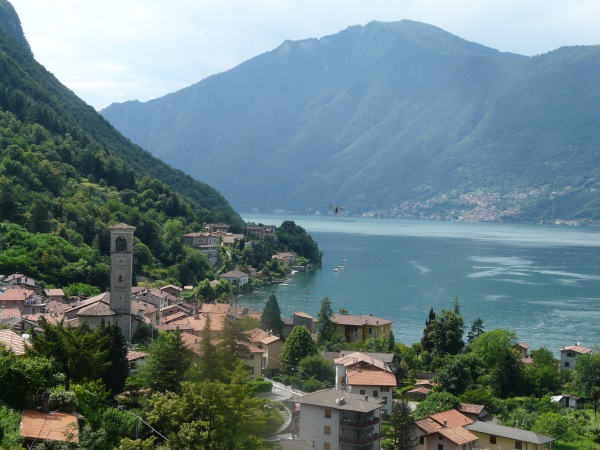
Nestled in between two peaks (Monte Bre and San Salvatore), we find Lugana. In the Ticino region, this is the largest city. Popular with Swiss citizens as a holiday and health resort, Lugano offers hiking opportunities that are unique, varied and quite special. One example is a first level hiking tour that starts with a boat ride across the lake to the Cantine di Gandria where you can stop at the intriguing Smuggler Museum and go on to a colorful fishing village just steps away from the Italian border.
Monte Tamaro – Monte Lema (Ticino)
One of the most beautiful of all Swiss hiking excursions, is the trek from Monet Tamaro to Monte Lema transverses the border between Ticino and Italy. Whatever direction you travel, the panorama sweeps over views of lakes and valleys encircled by the majesty of Monte Rosa and the Matterhorn.
Starting in Lugano and heading north, you can take a train or bus to the Monte Ceneri railroad station, Rivera-Bironeco. From there a gondola will take you to the famed church of Santa Maria degli Angeli, designed by architect Mario Botta. The view from the Church’s belvedere is absolutely spectacular and the Alpe Foppa restaurant is a pleasant place to spend the night.
Though challenging, a hike to the top of Monte Tamaro rewards you with a view that is well worth the effort. Hiking through the alp pasture from the Gradiccioli until you arrive at the Alpe Agarioe also involves a steep climb. Passing through Monte Magno, you’ll arrive at the Poncione di Breno. And a last uphill walk will take you to the top of Monte Lema, 1624 m above sea level. At that point, depending upon how you feel, you can take a chairlift to the village of Miglieglia or a walk downhill. Though this hiking tour can be done in a single day, many people opt for the experience of spending the night in a mountain hut.
Sentiero del Castagno (Path of the Chestnut) (Ticino)
Some 2000 years ago, the Chestnut Tree was brought to the south of Switzerland giving birth to the Chestnut Path. Beginning in the village of Arosio, the Sentiero del Castagno (Chestnut Trail) is a true highlight when it comes to Swiss hiking opportunities. The symbol of the chestnut appears on eight sign-posted locations, where you can obtain information about chestnuts and Malcantone, the landscape and the region’s chestnut culture.
Starting in Lugano a bus will take you to Arosio. From there it’s the Grotto Sgarnbada (typical restaurant) and then to the Chestnut forest of Induno. Close to the church of St. Michel is there is an old oven used for chestnut drying. From there, it’s on the village of Mugena with a fabulous view of the entire region of the Alto Malcantone. Next is a visit to the village of Mugena and further on to Busgnone, where you cross the river Magliasina. The next path goes through over the Firinescio valley over to the village of Vezio to Fescoggia.
And the hike continues down to Carrigio and then back to Mugena full circle to Arosio. In this Swiss hiking area, paths are maintained and financed by volunteers so, keep in mind that the going might be less than smooth. But, with a good pair of hiking shoes to help you along, it’s an experience that is not to be missed.
Navigation
[jbio template=”bootbomb0″]
0 comments