
From its stunning natural beauty to its temperate climate, Vancouver offers endless opportunities for outdoor enthusiasts. It’s also surrounded by mountains, forests, and other natural features, making it one of the best hiking destinations in North America and Canada. Some of the best hiking trails in Vancouver include:
St. Mark’s Summit
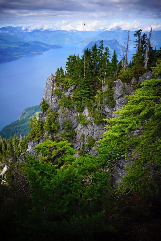
St. Mark’s Summit trail is a moderate round trip that is best trekked from May to October. This 11km trek has an elevation gain of approximately 460 meters, making it quite manageable for people with basic hiking skills. You should start your hike at the Cypress Mountain parking lot and then walk towards the large Olympic rings at the ski lodge. Here, you will see two markers, one for the Howe Sound Crest Trail and the other one for the Saint Marks Trail. You can follow whichever trail you want, as both will lead you to the same place. The two trails will meet on a well-maintained gravel road. From the gravel road, you should take your left and then follow the trail until you encounter a large junction with a map of the park. Keep following the trail until you hit St. Mark’s Summit.
You should have decent hiking and mountain climbing skills if you intend to hit this trail during winter since some sections are quite demanding. You should also bring a probe, shovel, as well as transceivers. The main risk that you will face on this trail is crossing Strachan. This area has historically experienced avalanches. If you will be hiking during the summer, you should bring at least 2 liters of water. Extra food, rain jackets, and layers are also recommended since the weather can change at any time. Also, you should bring a compass and a map. As much as the trail is straightforward, you should use this opportunity to polish up your navigational skills. Proper hiking boots are also required. Trekking poles will also make your journey a lot easier.
Dog Mountain
The Dog Mountain hike is probably one of the most popular hikes in the Mount Seymour region. It’s an easy, short hike, which offers plenty of scenic, spectacular views throughout the trail. As much as this trail has little elevation gain, it’s filled with roots and rocks, making it a bit technical. It also tends to be muddy and slippery sometimes, and that’s why it’s rated moderately difficult. You should, therefore, ensure you are wearing the right boots. But the entire trek is worth your time and effort. The Fraser Valley, Mount Baker, the Lower Mainland as well as the Strait of Georgia all offer amazing views. The Dog Mountain trek is quite busy during summer. Therefore, if you want to avoid the crowds, you should go for your trip during the first weeks of summer.
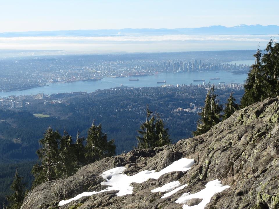
The trek begins in the northwest corner of the park’s parking lot. After walking for approximately 1 km, you will come across Frist Lake. From there, you should cross the small bridge and then walk along the shores of the lake. You will then come across a sign that will direct you to Dog Mountain. This section of the trail has some challenging hills. However, it’s well marked and easy to follow. After hiking for approximately 1.5 km, you will hit the top of a rocky outcrop, where you will enjoy stunning views of Stanley Park, Lions Gate Bridge, as well as downtown Vancouver. You can then have your lunch and then head back, using the same route
A permit will be required to hike these mountains between April 18 and June 14. Permits will not be needed from June 14 to April 17. Each permit allows the user to spend one day on the trail system. You can purchase up to four permits, which will allow you to spend up to four days on the trail system. It’s impossible to note that permits don’t guarantee a parking spot at the trailhead. Therefore, make sure you go early if you intend to park your car at the trailhead. Also, permits are allocated on a first-come-first-serve basis.
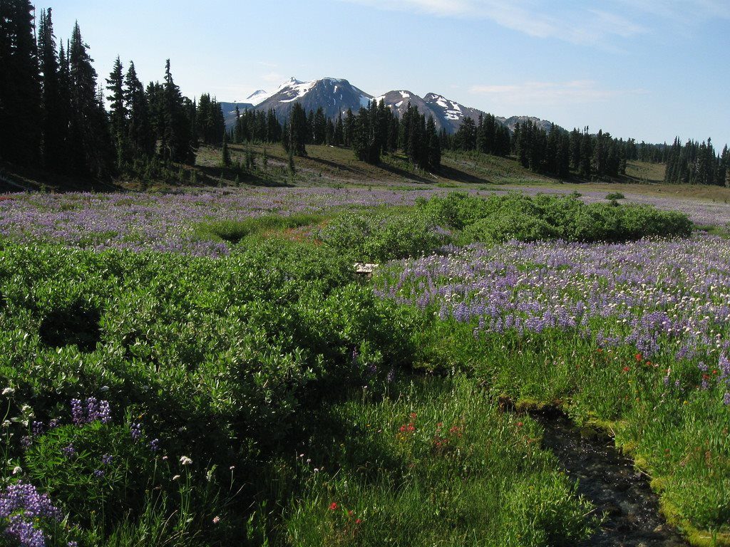
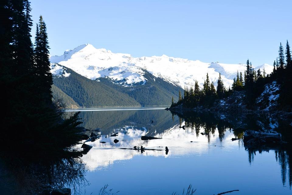
Garibaldi Lake
Garibaldi Lake is one of the most popular hiking destinations in southern British Columbia. Sitting at 1,450m above sea level, this lake is surrounded by stunning scenery such as alpine meadows, snow-capped mountains, as well as volcanic structures. Tourists and locals alike visit the Garibaldi Provincial Park during the summer to camp and hike around the lake, among other activities such as ski touring, climbing and sightseeing.

The Garibaldi Lake trek is an 18km round-trip hike, featuring an elevation gain of approximately 900 meters. It will take approximately 3 hours to complete the entire round trip. Summertime is the best time to go for this hike when the snow has already melted. It’s important to note that the weather patterns can change drastically around the lake. Therefore, make sure you are adequately prepared with the right gear. Also, remember to carry ample water and snacks. Also, you should plan your trek in a way that you will have sufficient time for rests and sightseeing since you will want to capture hundreds of photos.
The hike starts at the Rubble Creek parking lot and then takes you to a well-established trail, where you will encounter several switchbacks. It will then lead you to a lookout, where you can capture some photos and take a breather. From the lookout, the trail will then level off, to give you some great views of the Barrier. From this point, you will then follow the trail markers all the way to the Garibaldi Lake campground. While the entire trail is fairly flat, it’s also filled with rocks and roots that can trip you up. Therefore, you need to be extra cautious.
Camping is allowed at the Taylor Meadows campground and the Garibaldi Lake campground. However, you need to reserve a spot, before arriving at the campgrounds. Campgrounds have access to drinking water and pit toilets but there is no electricity. However, you will need carry your own tent. Also, you must pack out all the garbage that you bring with you. The Taylor Meadows campsite has a hut where you can store your food safely. However, sleeping is not allowed inside the hut.
Eagle Bluffs
Located in Cypress Provincial Park in West Vancouver, the Eagle Bluffs via Black Mountain is a moderately difficult trek that you can do during early summer or spring. This trail is heavily trafficked by locals, and it’s mainly used for nature trips, hiking as well as bird watching. At the end of the trail, you will enjoy stunning views of Mount Baker, Point Roberts, Vancouver, Eagle Harbor, Bowen Island, and Howe Sound, just to name a few. The trek will also take you across two summits of Black Mountain, while also giving you a chance to swim in the gorgeous Cabin Lake. You will also pass several other subalpine lakes along the way, making the entire trek exceptionally serene.
You have two options when it comes to doing this hike. Option 1 is probably the most popular one. You will start your trek a the alpine skiing area at the parking lot of Cypress Mountain. From there, you can summit Black Mountain, head over to Eagle Bluffs and then finish your journey at the parking lot. For option 2, you will access Black Mountain and Eagle Bluffs from the parking lot at Nelson Canyon, just below Highway 1. This route is a bit harder than option 1. June to October is the best time to hit this trail. Dogs are allowed on this trail, as long as they are on a leash at all times. However, camping is not allowed at Eagle Bluffs. You can find washrooms and other amenities at the Cypress Mountain downhill ski, close to the parking lot. The entire round trip is approximately 8km, with an elevation gain of 350 meters. No permits or fees are required to trek on this trail. Freshwater is readily available at the trailhead.
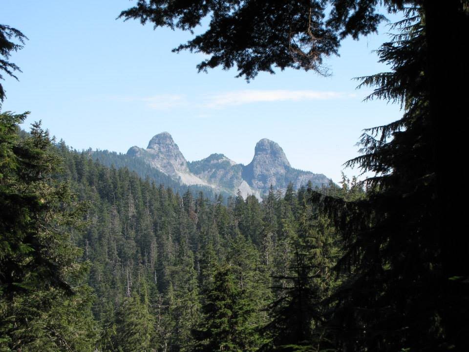
The Lions
The Lions are a set of two peaks that can be spotted from most parts of Vancouver. The town of Lions Bay, as well as Lions Gate Bridge, all get their name from these two peaks. The terrain is difficult and steep. Also, you may encounter some snow in certain areas of the trail, even during the summer. Therefore, this hike is reserved for experienced hikers. Despite the challenging terrain, this is one of the most rewarding hikes in Vancouver. You will enjoy incredible views of the greater Vancouver, Mount Unnecessary, Mt. Baker, and Mt. Washington. To the west, you will enjoy views of Vancouver Island and the Sunshine Coast while the northern side offers views of Mt. Harvey, Mt. Brunswick as well as the Garibaldi Park.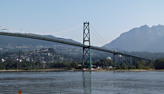
Only the west peak of the Lions as accessible, since the east one lies within the Vancouver watershed. If you are a seasoned mountaineer, you can summit the west lion during the summer months. However, the ascent is also quite dangerous, since it has plenty of exposure. Any misstep that you make can mean the end of your life. Therefore, it’s not encouraged. You can get to the Lions using two different trails. You can either follow the Howe Sound Crest Trail from Cypress Mountain or do it from Lions Bay. The Lions Bay route is slightly shorter than hiking from Cypress Mountain. On the other hand, starting from Cypress Mountain comes with the benefit of more parking spots. Also, the Cypress Mountain route is more picturesque.
Closing Remarks
Whether you are a local, visiting for the weekend or you are in Vancouver for an extended vacation, your options are almost endless when it comes to hiking trails in Vancouver. You just need to choose a trail that aligns with your hiking experience and physical fitness.
0 comments